

~~*Welcome to our "find us" page!*~~

The light green dot in the center of the image is our location. Maps below. click
We hope you find this page informative. Visitors are always welcome here at Singing Falls. For your convenience we recommend that you call or preferably email before you come to make sure we can facilitate your arrival. Below you'll find maps and other pertinent information to accommodate your stay in our area. There are top notch hotels and motels within a reasonably short distance of the ranch. Please be mindful that the roads to Singing Falls are very narrow and curvy for the ten miles coming from either direction on Tiller Trail Highway. Do exercises due diligence when driving.
Here is our contct information:
Stanley & Alexandra Petrowski
34620 Tiller Trail Hwy.
Tiller, Oregon 97484
mohair@singingfalls.com
Here are some links for quick references:
Click on the bar below to get a five day forecast
![]()
Weather:
Tiller is located in southwest Oregon, along the west slope of the Cascades. The district is 365,000 acres, with elevations ranging from 1,045 to 6,800. The predominant timber type is Douglas-fir and hemlock, with stands of Ponderosa and Sugar Pine on drier sites. Stands of oaks, cedars and other unique trees species are everywhere. The topography is generally rugged with steep ridges cut by numerous creeks and streams. The climate is generally mild, with average winter temperatures in the low 40s and summer temperatures in the low 80s with some extremes on the high and low scale. Rainfall averages about 39 inches per year. Snow levels and accumulations vary from year to year, but significant accumulations can usually be expected from 3,500' up. There is only occasional snowfall at the ranger station, and accumulations are rare. Singing Falls is sited 1440 feet above sea level.
~~*Traveling to Southern Oregon???*~~
Live Road Cameras
Click Here ForI-5 Pass Siskiyou Summit
I-5 Siskiyou Summit
I-5 at Mt.Sexton S/B
I-5 at Mt.Sexton S/B
Hwy 140 Lake of the Woods
Singing Falls is located well within the boundaries of Umpqua National Forest yet it is easily accessible from either the Medford/ Grants Pass region or the Roseburg/Eugene districts. This provides a broad range of cultural and natural attractions ranging from pristine wilderness areas and ancient old growth forests to wineries and the famous Shakespeare festival of Ashland. The Applegate Trail pioneer museum on interstate 5 between Grants Pass and Canyonville (in Sunny Valley) features a close look at the first trail blazed from California to the fertile valleys of Oregon. Our oxen, Bright and Tears, along with Stanley, the drover, are "stars" of a multimedia film presentation at the museum. Historical Societies abound and they have done a great job preserving and presenting to the public the rich heritage of the surrounding vicinity
TOPPoints of Interest:
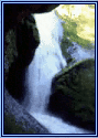
South Umpqua Falls and Umpqua National ForestRogue River National Forest
Crater Lake Images
Crater Lake Lodge
Oregon Caves National Monument
Oregon Shakespeare Festival
Wildlife Safari: drive through a wild life preserve.
Ocean Beaches:
www.sova.org/A good listing of attractions in this area.TOP
Recreation
This region is a naturalist's dream world. We have annual excursion events centering on the phenomenally diverse local flora and fauna. Here you will find hiking, boating, fishing, swimming, camping facilities, and horseback riding within areas of unique geological or ecological interest such as Crater Lake, Diamond Lake and the wide range of Wilderness areas. White water rafting on the Rogue River is a main summer attraction within a short driving distance. There are also numerous Farm and Wine tours.
The Umpqua National Forest covers nearly one million acres along the western slopes of the Cascade Mountains in Southwest Oregon. The Forest encompasses a diverse area of sparkling rivers and lakes, deep canyons, and rugged mountains up to 9200 feet in elevation, The Umpqua produces a wealth of water resources, timber, wildlife, fish habitat, minerals, and outdoor recreation opportunities. Included within the Forest are the North Umpqua Wild and Scenic River, a portion of the Rogue-Umpqua Scenic Byway, three wildernesses and the Oregon Cascades Recreation Area. Also within the Umpqua is the Diamond Lake Recreation Composite, one of the largest developed recreational facilities within the Forest Service.
The South Umpqua River originates on the district and has runs of steelhead, coho, and chinook salmon, and a resident population of trout and small mouth bass. Game animals on the district include blacktail deer, elk, black bear, and wild turkey. There is also an abundance of non-game species including the endangered peregrine falcon.
Recreation opportunities abound including fishing, hunting, hiking, swimming, picnicking, rock-hounding, and camping. The Rogue-Umpqua Divide Wilderness Area is a 33,000-acre, high mountain wilderness separating the Rogue and Umpqua drainages. There are 100 miles of hiking trails on the district and 20 developed recreation sites. There are also wilderness lakes and ponds, with fishing year round, and miles of streams open for summer angling.
TOPAccommodations
Local Hotels and B&B's near us:
www.upperrogue.org/dining_lodging.html
Transportation
Air: Medford International Airport
Bus: Medford, Grants Pass Canyonville, Roseburg
Highways
Interstate 5 is to our West and Hwy 62 (Crater Lake Highway) is to our South. It's easy access on highway 227 to Singing Falls from either of these highways. Entrance on to 227 from Interstate Five is gained at Canyonville, Oregon. 227 is known as the Tiller Trail Highway and entered from Crater Lake Highway (62) at the junction in Trail, Oregon. The black outlined location is Douglas County Oregon. The light green outlined area is Umpqua Nation Forest. The large blue dot is Crater Lake National Park.
Oregon Maps
Regional map. Light green Dot is Umpqua National Forest Boundry.


I love birds eye views so I have compiled some space satellite imagery with Singing Falls at the epicenter. They can be seen here. Be forewarned it's a big page.
Local Map of Douglas County Oregon Main Roads to Singing Falls


